-
Desktop studies for geo-services

Desktop studies are conducted during the Front-End Engineering Design (FEED) phase of marine subsea telecommunication projects. The desktop study is…
-
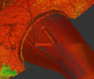
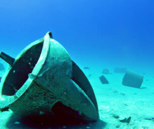
Geophysical Survey
Working with selected specialist partners, Acteon draws on a full range of survey techniques, from multibeam bathymetry to side-scan sonar…
-
Hydrographic Mapping
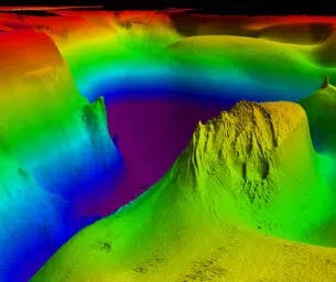
Acteon’s experience and expertise lead the industry in both data acquisition and processing of seafloor mapping information within all industry…
-
Industrial Measurement Services
Acteon's services reduce the uncertainty in as-built asset conditions, and also verify dimensions and positional accuracy on new-build infrastructure and…
-
Metocean surveys

Our metocean equipment and survey services are fully integrated to support projects in offshore and coastal environments. Understanding how water…
-
Onshore Surveys
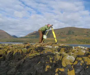
Ground-penetrating radar provides the critical subsurface information of soil structure, rocks, ice, and buried utilities. Acteon's modern data acquisition technologies…
-
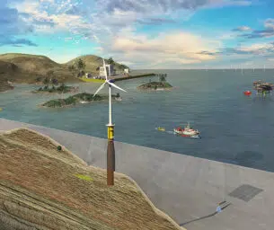
UXO and Boulder Identification Surveys
We efficiently collect data, conduct analysis, and report for Alarp UXO certification to support offshore wind project development.
- Acteon Home
- Industries
-
Divisions
-
Data and Robotics
-
Electronics and tooling

Brands in this segment


-
Geo-services
Brands in this segment


-
Structural monitoring
Brands in this business unit
 Engineering, Moorings and Foundations
-
Advanced Systems Engineering

Brands in this segment


-
Marine Foundations
Brands in this segment


-
Moorings and anchors
Brands in this segment

 Energy Services
- Corrosion Management
-
Cutting and decommissioning

Brands in this segment

-
Energy Resourcing
Brands in this business unit

- Flex-lay and Retrieval
-
Electronics and tooling
- Products & Services
- Integrated Solutions
- About Acteon
- Contact us