


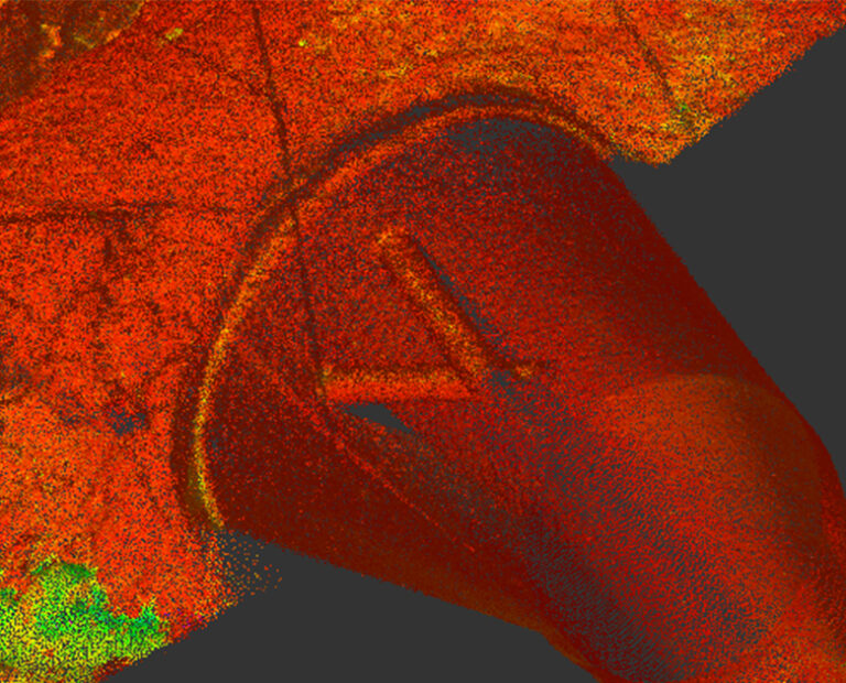
RENDERING ONLINE GEOSPATIALLY ACCURATE AND MEASURABLE 3D DATASETS THAT PROVIDE DECISION-MAKERS WITH THE INFORMATION THEY REQUIRE BY REDUCING COSTLY SITE REVISITS.
Integrity monitoring is key for accurate and successful remediation planning. Our services reduce the uncertainty in as-built asset conditions and verify dimension and positional accuracy on new-build infrastructure and assets.
Services include:
3D asset modelling, 3D laser scanning, 4D aerial rectified surveys, bridge and dam scour surveys, dimensional control surveys, locks and dam surveys.
Delivered by TerraSond
TerraSond specialises in collecting, compiling, and identifying geospatial and geophysical information that provides the best possible solution offering the lowest risk for customers in energy markets.

Integrate this product
Acteon can also offer an integrated project management service. This involves managing the activities of one or more of our companies on a customer’s behalf and providing a single point of contact for all aspects of project management.
GEO-SERVICES BROCHURE
Discover more about our solutions to real customer challenges and explore our full range of services to help you achieve project efficiencies.
Similar products and services
-
Ground-penetrating radar provides the critical subsurface information of soil structure...
-
Desktop studies are conducted during the Front-End Engineering Design (FEED) phase of...
-
Working with selected specialist partners, Acteon draws on a full range of survey...
-
Acteon’s experience and expertise lead the industry in both data acquisition and...