


Geo-services
Geo-Services Specialisms
GEO-CONSULTANCY
- A full range of consultancy services to provide customers with optimal geophysical, geotechnical and construction design.
- Access desktop studies; constructability review; foundation design and analysis; trenching and excavation analysis and pipeline and cable routing.
- We maximise the value of data through specialised analysis, and identify geohazards and design constraints to help reduce risk and improve project efficiency.
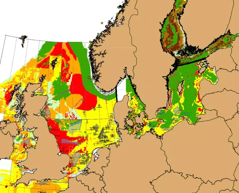
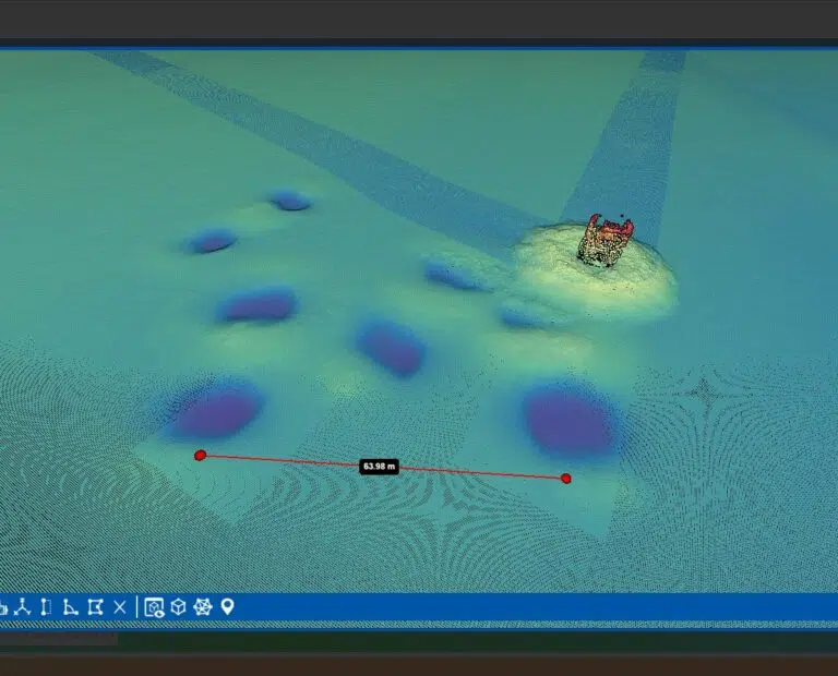
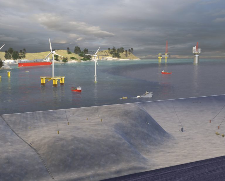
GEOPHYSICAL SITE CHARACTERISATION
- Get accurate and timely seabed geophysical surveys that are essential to the cost-effective design of marine structures and subsea installations.
- Access business critical data using the most advanced sensors and data recording systems.
- Acquisition and processing services of high-resolution geophysical and data ensures accurate assessments of site characteristics.
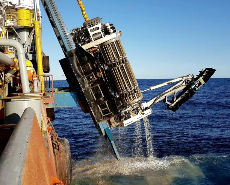
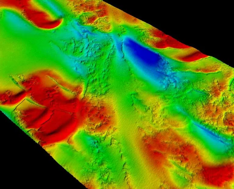
GEOTECHNICAL SITE INVESTIGATION
- Access high quality data allowing customers to understand the composition and structure of the seafloor geology supporting optimised design.
- Gain accurate data in the most challenging conditions; in proximity to existing platforms, pipelines or seabed structures; and across all ground conditions and slopes.
- Our recognised brands and innovative in-house, proven technologies include being the unmatched leader in seabed drilling through our Portable Remotely Operated Drill (PROD) for downhole drilling, and shallow soil investigation and testing using GeoROV.
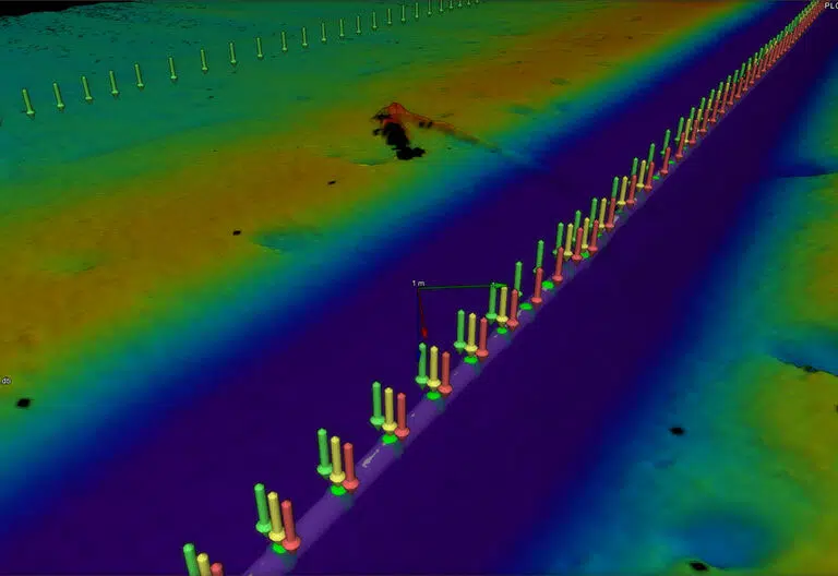
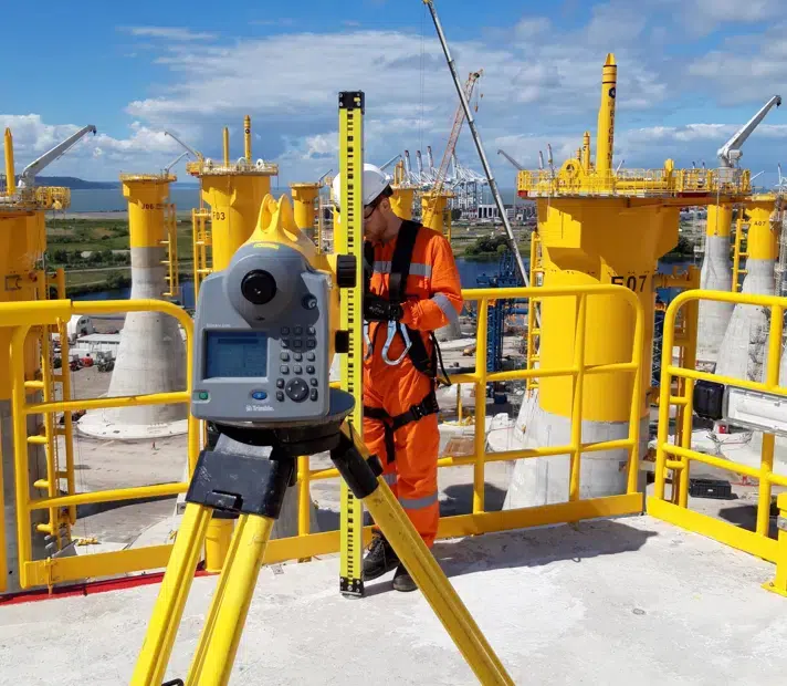
CONSTRUCTION SUPPORT SURVEY
- Support for all phases of construction; pre-engineering and pre-installation surveys, pipelay and structure installation, metrology and as-built reporting using a wide range of technical solutions including LBL (Long Baseline), laser and photogrammetry methods.
- Our track record includes over 800 construction support projects.
- Experienced offshore teams assisted by onshore project management and survey technical support to ensure the highest quality of service, minimising survey-related downtime.
DIGITAL SOLUTIONS
- Specialising in 3D asset management and software solutions, we capture, process and deliver spatially referenced data across the lifecycle of projects.
- Acteon’s proprietary 4D virtual asset management solution, iSite, allows customers to remotely manage any assets from their desktop, driving down the cost of offshore planning and communication.
- Remote access and assessments of marine assets reduce personnel on board (POB) without compromising safety.
ASSET INTEGRITY MANAGEMENT
- Project management, analysis and planning for client inspection repair and maintenance (IRM) projects.
- Online and offline survey systems that interface with and provide data feeds to conventional vessel and ROV (Remotely Operated Vehicle) based inspection campaigns.
- Pre-lay, depth-of-cover verification, condition status, and geospatial positioning for both onshore and offshore activities with deliverables that meet or exceed regulatory reporting requirements.
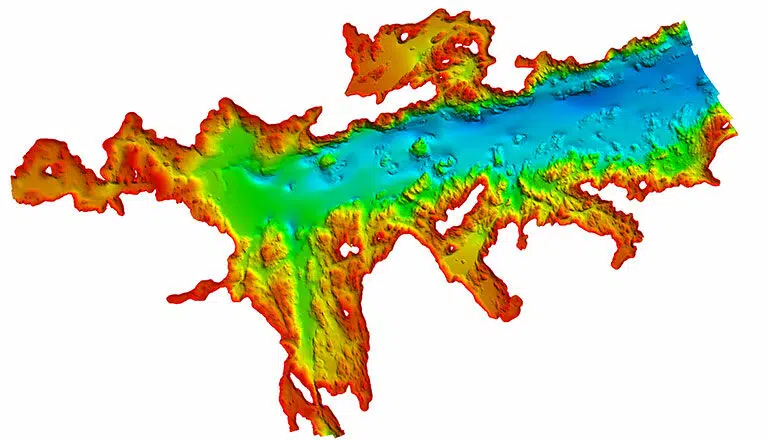
HYDROGRAPHIC / ENVIRONMENTAL
- Mapping and charting to support federal and local government agencies.
- Full range of mapping and data management services including coastline charting for safe navigation, permafrost studies, sinkhole studies, site hazard surveys, hurricane response for port access, underground utility locations, and unexploded ordnance detection.
- High quality metocean data to reduce uncertainty in engineering specifications and aid operational planning.
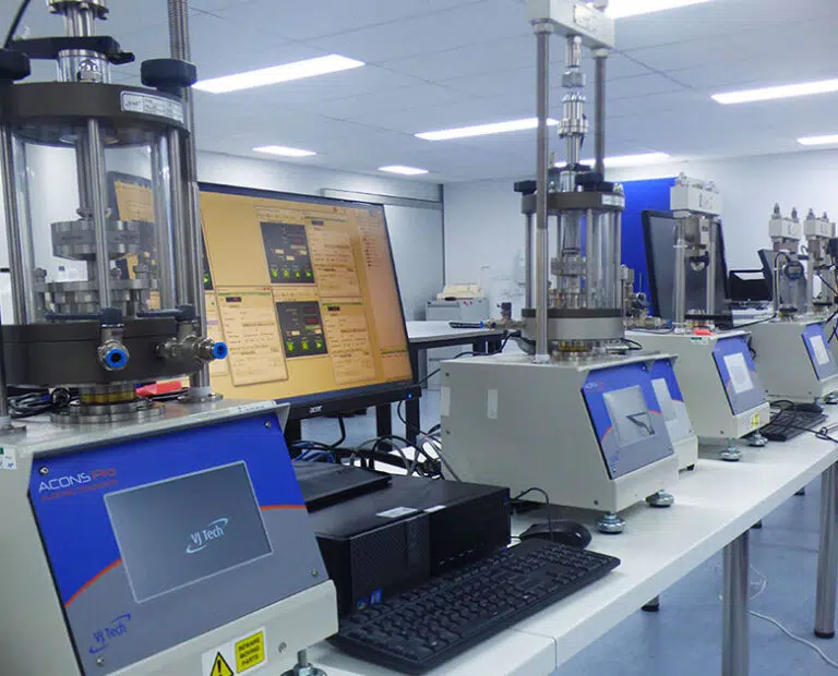
LABORATORY TESTING
- Geotechnical sampling activities are backed up by a state-of-the-art, in-house technology centre and a geotechnical laboratory that conducts geoscience research and development.
- High quality, relevant, timely test results and data to our clients for their structural design purposes.
- Interpretive reporting for the specific use, be it anticipated infrastructure, regional characterisation or geohazard studies.
LAND SURVEY
- Telecommunication site development and maintenance services that optimise processes and reduce costs.
- Geospatial surveys capturing, processing and delivering spatially referenced data.
- Bathymetric for hazard detection, navigation, flood assessment, water quality, dam removal, and reservoir management.
Access exclusive content
GEO-SERVICES BROCHURE
We are transforming data into critical insight driving key design and construction decisions.
Discover more about our solutions to real customer challenges and explore our full range of services to help you achieve project efficiencies.