


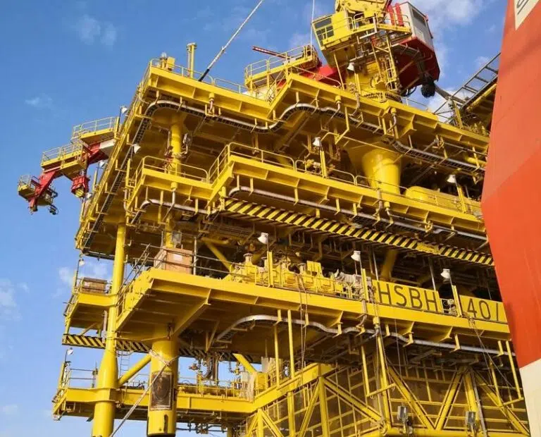
Construction support survey
SURVEY AND POSITIONING SERVICES TO LOWER THE COST AND IMPACT OF PLANNING AND INSTALLING SUBSEA INFRASTRUCTURE
With a track record of over 1,000 construction support projects successfully completed and over 4,000 years of combined survey experience across our Geo-services brands, Acteon has the experience and knowledge to make sure that survey projects are completed in the most efficient way to increase commercial value for our customers.
By working in partnership with Acteon, contractors and operators benefit from:
- Lowered cost and impact of planning and installing subsea infrastructure with specialist construction surveys across all lifecycle phases; pre-engineering and pre-installation, pipelay and structure installation, metrology and as-built reporting.
- Opportunities for efficiencies later in the lifecycle through early engagement with the Geo-services segment where we can seamlessly integrate with other parts of Acteon to reduce interfaces through a single point of contact.
- Integrated positioning and monitoring using the expertise of other Acteon brands including LDD for template design and fabrication and MENCK for piling.
- Surveys that are designed and deployed to use less equipment and optimise vessel usage to reduce the length and cost per survey.
- Dedicated teams that remain on a project from start to finish to ensure that knowledge is retained through the cycle.
- Minimal survey downtime and mobilisations using techniques including onshore project management and technical support.
- Delivery of any type of remote service for nearshore and offshore to reduce the cost and complexity of construction, operation, and maintenance for energy operators.
Solving your most pressing challenges
Acteon helps customers to minimise the total cost and impact of their operations by using highly accurate survey and positioning services that utilise engineering intelligence and digital technology.
Acteon solution
Through early engagement with the customer, Acteon can align the requirements to the tolerances of the task at hand which allows us to avoid using equipment that is over specification and enables us to streamline the service whilst delivering reliable data. The operational schedule is also optimized through the survey tasks within it.
Proof points
- We reduce personnel on board (POB) by up to 30% using remote technology.
- Over 10,000 km of pipeline surveyed globally.
- We have achieved a number of industry firsts, and brought new technology and techniques to the market such as using different navigation aids to reduce the amount of beacons required to cover the field.
- Pioneered a more intelligent approach to survey; replacing traditional monitoring techniques using software and modelling for example pipeline touchdown modelling replacing an ROV and vessel.
Read the case study
Delivery of a bespoke virtual management system
Acteon solution
Acteon executes accurate surveys first time, every time. We provide strategic localised positioning equipment across various regions to facilitate short-notice deployments for low-cost mobilisation.
Proof points
- We are experts in the use of Sonardyne, KONGSBERG and iXblue long-baseline and ultra-short-baseline subsea acoustic positioning systems.
- We have managed the survey and positioning requirements of numerous large subsea field developments, from pre-engineering surveys through construction and installation to as-built charting and deliverables.
- Early engagement has resulted in significant offshore time savings during the operational phase.
Read the case study
De-risking first-use LBL solutions to increase commercial value on FLNG project
Acteon solution
Acteon provides accurate and timely information in line with the project production schedule which is quick and easy to access. The data provided aids key decision making over the course of a field development campaign, allowing the customer to optimise their installation campaign.
Proof points
- We optimise use of software packages and appropriate sensors on both ROV and trenchers to document seabed and pipeline conditions as per specifications using learnings from experience in the field.
- Customers regularly request for us to take third-party seabed data and integrate it into as-built data sets, meaning that they trust our robust QC processes.
- We have an excellent track record in trenching support with major operators across the globe.
- 30+ AUV Projects successfully completed.
Acteon solution
We are experts in LBL/Metrology and use skilled technicians within the industry who are equipped to use varied techniques and methodologies depending on site characteristics, ensuring that a spool piece fits the first time, keeping the project on the critical path.
Proof points
- Have an extensive track record with acoustic, photogrammetric and LIDAR based spool metrology.
- Developed industry leading metrology QC tools and techniques to ensures quick/accurate analysis of metrology data.
- Design and fabricate bracketry / metalwork / interface plates under a single contract within Acteon to ensure precision and minimise project interfaces.
- Over 400+ successful jumper metrologies delivered worldwide.
Acteon solution
Acteon ensures timely and accurate reporting time using techniques such as automated field reporting and remote access to survey data from onshore locations to maintain the installation schedule of the project.
Proof points
- We work with navigation software providers to develop automated field reporting within our software packages, maintaining capacity with smaller teams.
- Provide remote access to survey data from onshore locations allows us to increase reporting capacity remotely through times of stretch.
- Have a global pool of experienced project surveyors and data processors supporting projects to provide consistent deliverables in all regions.
A proven suite of products and services
We design and deploy surveys that use less equipment and optimise vessel usage to reduce the length and cost per survey, ensuring the most cost and environmentally efficient delivery of projects.
Geo-services specialisms
Offering a single point of contact to drive project efficiency; our focus is to reduce the cost, complexity and time of receiving superior geo-data.