


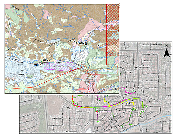
Organising data in a graphic format allows clients to confidently share information with multidisciplinary teams and government agencies
Providing clients with the visual and informational aid of Geographic Information System (GIS) software to create detailed maps to meet the complexities of oil and gas industry permitting and planning.
Our GIS Services include:
- Geotagging/GPS Data Collection
- Data/maps analysis & management
- Spatial data processing
- Database development & population
- Conversion of CAD/Excel data to GIS
- Google Earth to GIS database hyperlinking and integration
- Data modelling
- Incorporation of aerial images and topographic information
- Incorporation of GIS databases from different sources: DOGGR wells and fields, county permit boundaries, water blue lines, flood zones, hydrologic units, wetland boundaries.
We use GIS tools for the following:
- Conditional use permits, zoning clearances
- Asset and well inventories – data organized in tabular and visual formats
- Easement and encroachment permitting
- Stormwater/NPDES Permits
- Maps/figures for permit compliance plans
- Area of Review for injection wells/UIC
- Planning of facility boundary, pipeline routes and well drilling
- Lease purchase due diligence
- Biological and archaeological maps/surveys.
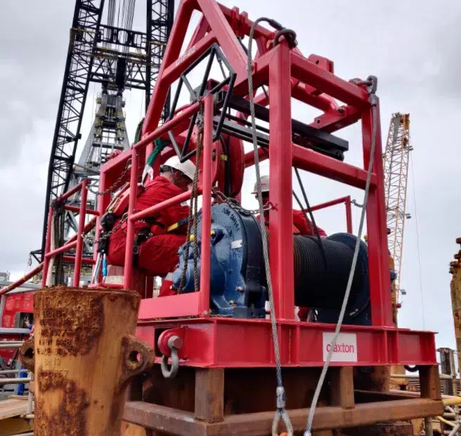
Delivered by 2H Offshore
2H Offshore is a global engineering contractor specialising in the design, structural analysis and integrity management of offshore energy systems.

Integrate this product
Acteon can also offer an integrated project management service. This involves managing the activities of one or more of our companies on a customer’s behalf and providing a single point of contact for all aspects of project management.
Access exclusive content
DRILLING AND DECOMMISSIONING SERVICES - REQUEST MORE INFORMATION
Fresh thinking and technical innovation for wells and offshore infrastructure installation and removal.
Acteon’s expertise in drilling and decommissioning spans decades and covers the full lifecycle of a project from the acquisition of subsea information and data, to bespoke drilling packages to onshore disposal and recycling.
SIMILAR PRODUCTS AND SERVICES
-
Experienced in both offshore and onshore environments, Acteon’s registered project and...
-
Assistance and advice to prepare and submit an Oil Spill Contingency Plan (C-Plan) to the...
-
The array of monitoring systems provided by Acteon are used for a variety of subsea...
-
Acteon's experienced wellbore integrity review team perform detailed analysis of wellbore...