


Acteon Equipment sales & rental Electronics & Tooling HydrographicSingle & Multibeam Echosounders
Single & Multibeam Echosounders
Return to HydrographicSearch products
X Products selected
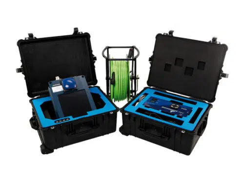
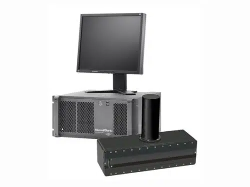
Coda Octopus Echoscope
Echoscope is the world’s highest definition real time 3D imaging sonar. By generating over 16,000 beams per acoustic transmission and with a frame rate of over 10 pings per second, Echoscope® sonars provide unique underwater 3D acoustic movie imagery. Viewing the subsea scene in real time using patented 3D rendering techniques allows for immediate decision making during underwater positioning projects, whilst maintaining a measurable dataset for mapping purposes.
- High definition 3D sonar image generated in real-time
- Mosaicing capability
- Displays complex moving structures accurately
- Accurate even in turbid water
- Suitable for installation on vessels, ROV, barge or crane
- Accurate geo-referenced data
- Versatile DTM output options
- Very easy to use even by non-sonar experts such as crane operators and law enforcement officers
Used in a number of applications ranging from Port Security, IRM (Inspection, Repair and Maintenance), and cable or mattress laying through to marine construction and ROV intervention work, the Echoscope has proved to save vessel time and increase productivity during zero visibility subsea conditions.
Compact and portable and with the choice of either single frequency or dual frequency systems, the Echoscope can be rapidly deployed on vessels using an over-the-side pole mount or alternatively integrated onto a number of different ROVs or AUVs.
Each Echoscope 3D sonar is supplied with the modular USE (Underwater Survey Explorer) topside software package which can integrate the sonar to a number of auxiliary sensors like motion, heading and positioning systems.
The combination of Echoscope and USE software with their unique and patented capabilities is changing the mode of many subsea operations around the globe.
The Echoscope can be supplied in OEM form for integration with subsea vehicles to perform unique 3D inspections and surveys. CodaOctopus can supply technical integration packs and consultancy to allow the client to seamlessly integrate the Echoscope.
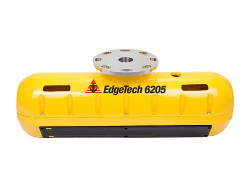
Edgetech 6205: Combined Bathymetry & Side Scan Sonar
The 6205 utilizes EdgeTech’s next generation bathymetric technology to provide an enhanced and fully integrated, swath bathymetry and dual frequency side scan sonar (SSS) system.
- Next Generation EdgeTech Bathymetric technology
- Wide swath coverage in shallow water, up to 12 times water depth
- Co-registered dual frequency side scan and bathymetry with full nadir coverage
- Improved Depth Performance
- New lightweight Sonar head
- Superior Multipath and surface reflection suppression
- IHO SP-44 Special Order compliance with proven results
- Over 200° view angle with no nadir gap
- Equidistant and Equiangle output options
The 6205 produces real-time, high resolution, three dimensional (3D) maps of the seafloor while providing co-registered simultaneous dual frequency side scan imagery. The 6205 uses ten receive element transducers and one discrete transmit element. The high number of channels enables superior rejection of multipath effects, reverberation and acoustic noise commonly encountered in the shallow water survey environment.
Utilizing EdgeTech’s Full Spectrum® technology, the 6205 exceeds IHO SP-44, NOAA and USACE specifications for feature detection and bathymetric point data uncertainty. Near shore and shallow water hydrographic surveys are completed faster and safer utilizing the 6205 due to the wide swath (over 200º view angle), which is typically more than three times that of existing sonars that rely solely on beam forming techniques.
The 6205 utilizes EdgeTech’s latest electronics and arrays resulting in an extremely lightweight, modular design required for shallow water applications and vessels of opportunity.
The standard configuration for the 6205 includes an integrated sound velocity sensor and interfaces with standard GPS, MRU, SVP, CTD, Altimeters and Gyros. The 6205 interfaces to most 3rd party acquisition and processing software as well.
Kongsberg GeoAcoustics GeoSwath Plus
GeoAcoustics GeoSwath Plus offers very efficient simultaneous swath bathymetry and side scan seabed mapping with accuracies that have been shown to exceed the IHO Standards for Hydrographic Surveys.
- Ultra high resolution swath bathymetry
- IHO SP-44, special order
- Co-registered geo-referenced side scan
- Frequency versions: 125, 250, 500 kHz
- Up to 12 times water depth coverage
- 240º view angle
- Dual transducer set-up with versatile mounting options
- Full software solution included: data acquisition, processing, presentation
- Interfaces to all customary peripheral sensors
- Interfaces to all customary software packages
The applied phase measuring bathymetric sonar technology provides data coverage of up to 12 times the water depth, giving unsurpassed survey efficiency in shallow water environments. The same area can be mapped 30% to 40% faster using GeoSwath Plus than with a typical beamforming echosounder. The GeoSwath Plus comes as a turnkey solution, including the deck unit, compact sonar head and a full software package for data acquisition, processing, system calibrations and production of the final bathymetry grids and side scan mosaics. Alternatively the user can operate with any major third party software. The side scan data can be processed in GeoTexture software to give bottom classification and texture analysis.
NORBIT iWBMS Multibeam Sonar System
Introducing the all-new, compact and high resolution curved array bathymetric mapping system by NORBIT.
This all-in-one tightly integrated broadband multibeam turnkey solution offers high resolution bathymetry over a wide swath. The high-end sonar with Applanix WaveMaster II (globally leading GNSS/INS system) embedded into the unit ensures fast and reliable mobilization and highest quality sounding for suveys in all conditions.
The WBMS-series are based on a flexible sonar platform that utilizes the latest in analog and digital signal processing. With broad R&D expertise NORBIT has developed, from the ground-up, exciting new technology that allows existing and new applications to benefit from the advantages offered by a compact wideband curved-array multibeam sonar.
- State-Of-The-Art Curved Array Multibeam Sonar Tightly
- Integrated with High-end GNSSaided Inertial Navigation System (Applanix WaveMaster II)
- 80kHz Bandwidth
- Roll-stabilisation, Side-scan, Water Column, Backscatter, Snippets
- Simple Ethernet Interface
- Integrated Sound Velocity Probe
- Hydrodynamic Fairing
- Mounting Bracket Included
- FM & CW Processing
- Flexible Power
NORBIT Wideband Multibeam Sonar
For High Resolution Bathymetry. Powerful, ultra compact and high-resolution multibeam sonar from NORBIT.
The WBMS series is the most compact sonars designed for use on all platforms. With low power consumption, the system is suitable to operate from battery. NORBIT’s wideband multibeam technology facilitates long range real-time data collection and at the same time achieves high resolution data.
The WBMS sonars are based on a state of the art analogue and digital platform featuring powerful signal processing capabilities, offering roll stabilised bathymetry and several types of imagery and backscatter output. With broad R&D expertise, NORBIT has developed, from the ground-up, exciting new technology that allows existing and new applications to benefit from the advantages offered by a compact wideband curved-array multibeam sonar.
- Sub-centimeter Range Resolution
- FM & CW Processing
- 80kHz Bandwidth
- Simple Ethernet Interface
- Roll-stabilisation
- Backscatter outputs (Intensity, Sidescan, Sidescan Snippets, Snippets, Water Column)
- Multidetect
- Integrated Sound Speed Probe
- Exceeds IHO Special Order, CHS Exclusive Order & USACE New Work
R2Sonic 2022
The Sonic 2022 is a compact wideband shallow water multibeam echo sounder, suitable for a wide variety of general mapping applications.
Portability
- 60% the size of full length Sonic 2024 receive array.
- Ideal for integration to small AUV, ROV or small boat operations.
Versatile
- All options are available with the Sonic 2022.
- These are: Bathymetry with optional Ultra High Resolution (UHR), TruePix™ Backscatter, Raw Water Column, Pipeline Mode, Multispectral Mode, Forward Looking Sonar imagery. Only the option 90kHz/100kHz is exclusive to the Sonic 2026.
Wideband Operation
- Wide selectable operating frequencies between 170kHz and 450kHz in steps of 1Hz resolution.
- Optional 700kHz for detailed offshore site surveys such as pipeline inspections and cable laying operations and archaeological wreck surveys or micro bathymetry applications.
- High flexibility and control provided to users to avoid interference from other active acoustic systems.
Highest Resolution & Accuracy
- Focused Beamwidths 0.6⁰x 0.6⁰ at 700kHz.
- 60kHz signal bandwidth over primary frequency range.
- Bottom Detect Range Resolution of 3mm.
Productive
- Selectable swath coverage from 10⁰ to 160⁰, selectable on the fly, in real time during the survey operation.
- Range: 1m to 400m+.
Ease of Operation
- Signal Processor and Controller embedded in the Sonar head, making the Sonic 2022 well suited for AUV.
- Low weight, volume & power consumption (35Wavg).
Compelling value
- Latest advanced sonar technology.
- Warranty: 3-year with option for 6-year extended warranty
- Value priced.
- Trade-in rebate for older technology systems.
For information on position, heading resolution, pitch/roll accuracy and heave accuracy, please refer to the I2NS specification sheet.
(*) The speed of the survey is primarily limited by the installation of the MBE
The Sonic 2022 is highly portable – at 60% the size of a full-length Sonic 2024 receiver array. The form factor makes it ideal for integration into small AUV, ROV, or small boat operations. Customers around the world are able to sound to depths up to 400m+ in most typical environments.
The Sonic 2022 can be upgraded to Ultra High Resolution (UHR) – providing extremely narrow beamwidths of 0.6° x 0.6°at 700kHz operation. The narrow beamwidths at 700 kHz make this option invaluable for detail offshore site surveys such as pipeline inspections, cable laying operations, archeological wreck surveys or other micro bathymetry applications.
Few examples of applications:
- Construction
- Dredging
- Offshore O&G (pipeline)
- Offshore Windfarm (cables, towers)
- Autonomous Surface Vehicle (ASV)
- Remote Operated Underwater Vehicle (ROV)
R2Sonic 2024
The highly recommended Sonic 2024 Wideband Multibeam Echosounder (MBES) represents the latest in advanced modern system design and architecture, providing unprecedented system versatility, productivity and performance. The Sonic 2024 truly sets the standard for this class of MBES.
The Sonic 2024 can be upgraded to Ultra High Resolution (UHR), providing extremely narrow beamwidths at 700kHz operation. The narrow beamwidths at 700kHz make this option invaluable for detail offshore site surveys such as pipeline inspections, cable laying operations, archeological wreck surveys or other micro bathymetry applications. When UHR is selected, the beamwidth is 0.3° x 0.6° providing unprecedented small bottom footprints.
Few examples of applications:
- Autonomous Underwater Vehicle (AUV)
- Construction
- Dredging
- Offshore O&G (pipeline)
- Offshore Windfarm (cables, towers)
- Remote Operated Underwater Vehicle (ROV)
Versatile
- All options are available with the Sonic 2024. These are: Bathymetry with optional Ultra High Resolution (UHR), TruePix™ Backscatter, Raw Water Column, Pipeline Mode, Multispectral Mode, Forward Looking Sonar imagery. Only the option of 90kHz/100kHz is exclusive to the Sonic 2026.
Wideband Operation
- Wide selectable operating frequencies between 170kHz and 450kHz in steps of 1Hz resolution.
- Optional 700kHz for detailed offshore site surveys such as pipeline inspections and cable laying operations and archaeological wreck surveys or micro bathymetry applications.
- High flexibility and control provided to users to avoid interference from other active acoustic systems.
Highest Resolution & Accuracy
- Focused Beamwidths 0.3⁰x 0.6⁰ at 700kHz.
- 60kHz signal bandwidth over primary frequency range.
- Bottom Detect Range Resolution of 3mm.
Productive
- Selectable swath coverage from 10⁰ to 160⁰, selectable on the fly, in real time during the survey operation.
- Range: 1m to 400m+.
Ease of Operation
- Signal Processor and Controller embedded in the Sonar head, making the Sonic 2024 well suited for AUV.
- Low weight, volume & power consumption (50Wavg).
Compelling Value
- Latest Advanced Sonar Technology.
- Warranty: 3-year with option for 6-year extended warranty.
- Value priced
- Trade-in rebate for older technology systems.
For information on position, heading resolution, pitch/roll accuracy and heave accuracy, please refer to the I2NS specification sheet.
(*) The speed of the survey is primarily limited by the installation of the MBES.
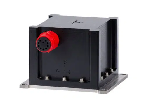
R2Sonic Integrated INS
The I2NS™ integrates seamlessly with R2Sonic Wideband Multibeam Echosounder Systems providing accurate and robust geo-referencing and motion compensation for hydrographic surveys.
The I2NS™ provides existing and new R2Sonic customers an industry proven, tightly coupled solution for vessel roll, pitch, heave, heading, position and velocity which is easy to set-up, operate and control through a monitoring window built into the R2Sonic graphical user interface. The elimination of additional processing modules reduces volume, size and cabling and allows all data flow through a single Ethernet port.
The I2NS™ is supplied in a compact waterproof housing which may be mounted on the vessel center of rotation or directly on the R2Sonic multibeam system mount bracket, to minimize patch-testing between mobilizations. All processing and interfaces are integrated into the compact Sonar Interface Module with connections for dual Global Navigation Satellite System (GNSS) antennas, the IMU and provision of serial input/outputs.
- Seamless integration with R2Sonic MBES
- Compact IMU in waterproof housing
- Superior accuracy for multibeam operations
- Inertially aided RTK positioning
- High immunity to GNSS outages
- Export license not required to most countries
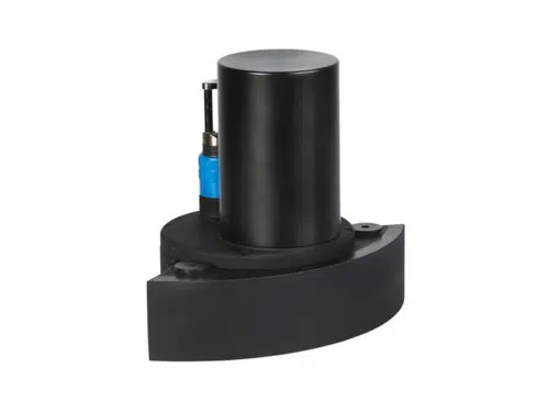
ROS PT – 10 Pan and Tilt Unit
The PT-10 is an oceanographic or nuclear pan and tilt featuring a reliable and rugged design, 3,000 meter depth rating, 10lb-ft torque output, 120 VAC or 24-28 VDC power, RS-485 or analog control, and aluminium or stainless steel housings. The PT-10 has a 1-year warranty and various connector options.
- Torque: 10 lb-ft (13.56 N-m)
- Accuracy: +/- 1.5° (90 arc minutes)
- Gear Backlash: 0.6° (36 arc minutes)
- Scan Range: 0 to 360° (both axes)
- Rotation Speed: 20°/ sec
- Power: AC: 120 VAC (0.14 amps); DC:24-28 VDC (1.5 amps)
- Control: RS-485 (half duplex)
- Networkability: up to 32 RS-485 nodes
- Motors: brushless electric
- Depth rating: oil filled: 3,000 meters, air filled: 30 meters
- Housing material: anodized aluminum or stainless steel
- Size: 9.30”H x 7.5” W x 3.0”D
- Weight in air: 10.5 lb (air), 11.7 lb (oil); water: 6.5 lbs (air), 7.7 lbs (oil)
- Operating temp: up to 122° F (50° C); storage: -4° to 140° F (-20 to 60°C)
- Connectors: various connectors available
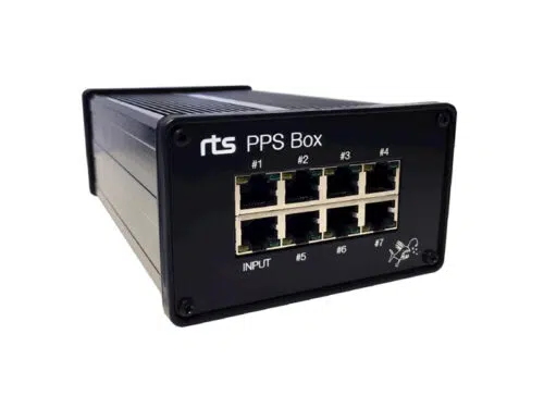
RTS PPS Box
Based on the RTS PPS Distribution Panel, the RTS PPS Box is a highly compact and robust solution for distributing GPS timing signals to survey spreads.
The unit features low latency distribution of one timing telegram together with PPS pulse to seven separate outputs. The RTS PPS Box is typically used for time synchronisation of sensors and logging systems.
- Seven-channel RS232 + PPS splitter
- Supports baud rates up to 115kbps
- Full RS232 levels (+/-8V)
- PPS TTL Level
- Low Latency
- Data and PPS indicators
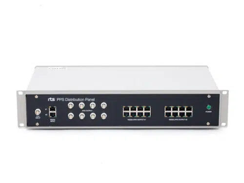
RTS PPS Distribution Panel
The RTS PPS distribution panel is the key solution for distributing GPS timing signals to survey spreads. It can be used to distribute one or two separate timing telegrams together with PPS pulse.
The system consist of two RS232 splitters combined with three PPS pulse splitters. Selectable PPS pulse width, 500us, 1ms or directly from the GPS. Selectable PPS trigging, positive or negative edge. Typically used for time synchronisation of logging systems and multiple sensor synchronization.
- Two eight-channel RS232 splitters
- PPS pulse width extender
- Supports baud rates up to 115kbps
- Full RS232 levels (+/-8V)
- PPS TTL Level
- Low Latency
- Data, PPS and power indicators
- ESD-protected inputs
- Selectable PPS trig
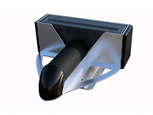
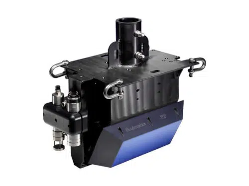
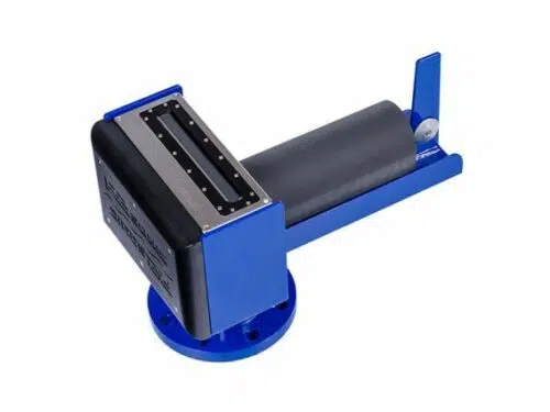
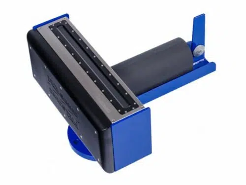
RTS Sonic 2024 Bracket
RTS and Invento Team have developed an ROV bracket for R2Sonic Sonic 2024 sonar systems. The purpose of the design is to reduce mobilization time and mounting errors, as well as providing added protection for a key component in an ROV survey spread.
The unit also features protected predetermined cable paths, minimal mounting points and a turbulence reducing design. To allow for safe transport and minimal assembly on site, a customized case is offered where the sonar can be shipped ready mounted in the bracket.
- Tailored for ROV use
- Rugged and compact design
- Easy, fail-safe sonar mounting
- Easy bracket mounting on ROV
- Protected encapsulation
- Turbulence reducing design
- Compatible with all 2024 models
- Customized transit case
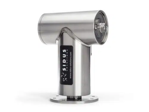
Sidus SS251 Heavy Duty Pan & Tilt
Sidus Solutions’ SS251 deepwater pan and tilt assembly is a powerful robotic positioning device.
Within a small footprint, you are now able to position heavy loads with ease and high accuracy. Like the SS109, the SS251 gains its dependability and ease of maintenance through integration of reversible synchronous motors, extremely low backlash harmonic drives and precision ball bearings into a unique modular motor assembly.
This workhorse offers impressive torque ratings up 65 ft-lbs securely locked into the corrosion resistant 316 stainless steel underwater housing. The distinctive modular design, simplifies field repair to using only small hand tools. Modifications can be made to include feedback circuits and limit switches for applications where rotational information is vital.
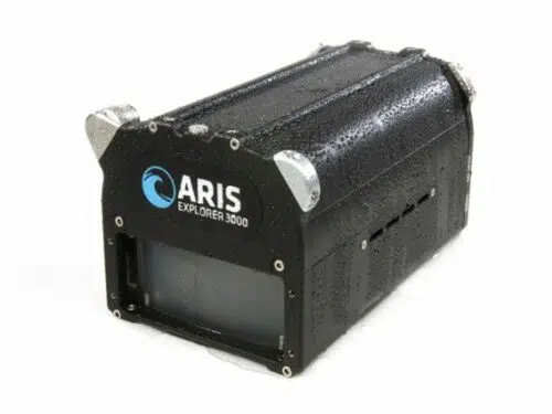
Sound Metrics ARIS Explorer 3000
With 128 beams operating at 3MHz, the ARIS Explorer 3000 collects more data than any other imaging sonar in its class. Users get unmatched image clarity, even in turbid waters. For longer-range applications, there are the Explorer 1800 and 1200 models.
The entire ARIS line is built to deliver in the most challenging situations. A smaller size, newly developed software and more efficient power usage, makes the ARIS Explorer family ideal for ROV integration. The ARIS Explorer 3000 works in zero visibility and operates in waters from the arctic to the equator.
- Dual Frequency, 3.0 MHz & 1.8 MHz
- Unprecedented High – Definition Imagery
- Capable of imaging at close range
- Dynamic Focus
- Built in compass & depth gauge
- Compact & lightweight
- Low Power Requirement
- Easy Integration
- Ethernet Interface
- Windows™ based Software
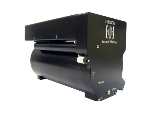
Sound Metrics Didson 300
No other sonar in its class is able to deliver the image quality and frame rate of the DIDSON 300 m. The resulting real-time, near video-quality data is clear enough to study the behavior of darting fish, even in opaque waters.
A de facto standard for the exacting marine biology audience, this dual frequency sonar is also ideal for construction inspection, pipe laying observation, hull and berth sweeps and other mission critical jobs down to 300 meters.
The DIDSON is versatile, too, with a 1.1 MHz detection frequency capable of imaging targets up to 30 meters away.
Stored images can be converted to AVI files and JPEGs, and a size and distance tool is included, making analysis accurate and presentation easy.
- Identification Frequency: 1.8 MHz
- Detection Frequency: 1.1 MHz
- Depth Rating: 300m
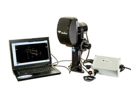
Teledyne Blueview BV3200 Boat Mount with GPS
Teledyne Blueview BV3200 Boat Mount with GPS
The BV3200 is integrated with GPS and a Compass to provide operators with geo-referenced data enabling them to find the position of objects with ease. When used with Teledyne BlueView’s ProMapper software, users can easily create geo-referenced mosaicked sonar maps overlaid on satellite images or nautical charts.
Applications
- Search and recovery
- Port and Harbor inspections
- Large area mapping
- Site clearance surveys
Benefits
- Easy installation and deployment
- Integrated GPS and compass for accurate target positioning
- Increase security, safety & efficiency
Features
- Integrated GPS and Compass
- Manual tilt adjustment up to 25 degrees
- GPS coordinates displayed on sonar image and recorded to raw data
- Operates at speeds up to 5 knots
- 1-person operable
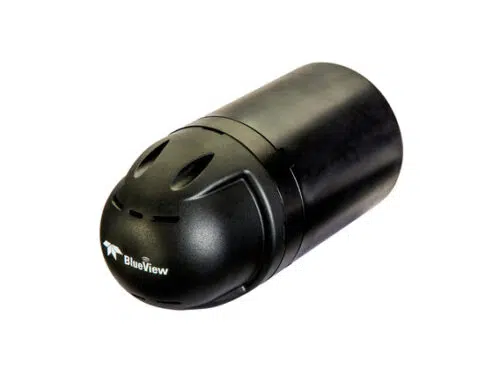
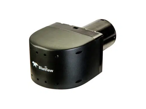
Teledyne Blueview BV5000 3D Mechanical Scanning Sonar
BlueView’s BV5000-1350 and BV5000-2250 3D mechanical scanning sonar create high resolution imagery of underwater areas, structures, and objects. With the touch of a button, these new 3D mechanical scanning sonar create 3D point clouds of an underwater scene with minimal training required. The compact, lightweight units are easily deployed on a tripod or an ROV.
The scanning sonar head and integrated mechanical pan and tilt mechanism generate both sector scans and spherical scan data. For the first time, get 3D laser-like scanning capabilities underwater, even in low and zero visibility conditions and seamless integration with traditional laser scan imagery.
Applications
- 3D site survey
- 3D structure inspection
- Oil rig decommissioning
- Bridge inspections
- BlueView metrology
Benefits
- Easy, one touch scan function
- 3D mosaic imaging without position info
- Easily combined with laser scan imagery
- Compact size fits into tight spaces
- Operates in low & zero visibility conditions
Features
- 2 model options (1.35 & 2.25 MHz)
- Standard Ethernet/RS485 interface
- Easy Windows based software
- Leica Cyclone data compatible
- Sector & spherical scans
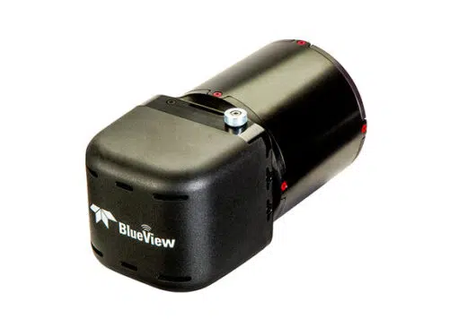
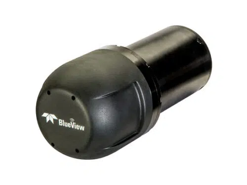
Teledyne Blueview M900 Deep Series
BlueView’s M900 deep series, rated to 4,000 m, has been engineered to provide deep sea operators with the most reliable deep water imaging sonar system on the market.
Applications
- ROV Navigation
- Obstacle Avoidance
- Situational Awareness
- Operations Monitoring
- Area Survey/Site Clearance Survey
- Touchdown Monitoring
Benefits
- S3 electronics
- 30% lighter, smaller, faster and power then P Series
- Automatically adjust transmit power level to imporve imagery up close and at long ranges
- UDP broadcast modes
- Built in hardware triggering options
- Built in target tracking options
- Easily fits on any platform
- Expanded area coverage
- High-resolution imagery
- Unaffected by motion
- Easy automation of nav-control systems
Features
- Streaming video-like sonar imagery
- Continuous situational awareness
- Multiple field-of-view options
- Depth rated to 4,000 m (13,123 ft.)
- Plug & Go operation
- Intuitive Windows® based software
- Software Development Kit available
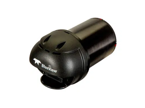
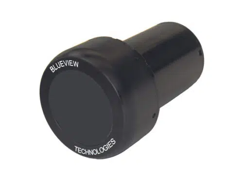
Teledyne Blueview M900 Series
The industry’s most compact, full featured 2D Multibeam Imaging Sonar available. Engineered to fit in small, tight spaces the M Series is 30% smaller than the popular P Series, and delivers the same crisp, real-time sonar imagery.
Applications
- All Condition Navigation
- Object DetectionObstacle Avoidance
- Situational Awareness
- Operations Monitoring
- Area Survey/Search & Recovery
- Touch Down Monitoring
- Diver/Swimmer Detection & Tracking
Benefits
- S3 electronics
- 30% lighter, smaller, faster and less power then P Series
- Automatically adjust transmit power level to improve imagery up close and at long ranges
- UDP broadcast modes
- Built in hardware triggering options
- Built in target tracking options
- Easily fits on any platform
- Expanded area coverage
- High-resolution imagery
- Unaffected by motion
- Easy automation of nav-control systems Detection & Tracking
Features
- Streaming video-like sonar imagery
- Continuous situational awareness
- Multiple field-of-view options
- Depth rated to 1,000 m (3,280 ft.)
- Plug & Go operation
- Intuitive Windows® based software
- Software Development Kit available
Teledyne Blueview M900-2250 Series
Teledyne BlueView’s M900-2250 series includes a 900kHz with 130 degree field of view and 2250kHz with 130 degree field of view in a compact package. The M900-2250-130’s field of view has been increased by over 125% from the previous dual frequency model.
Applications
- Obstacle Avoidance
- Vehicle Navigation
- Long range detection and close range identification
- Operations Monitoring
- Situational Awareness
- Touch Down Monitoring
- Diver/Swimmer Detection & Tracking
Benefits
- S3 electronics
- 30% lighter, smaller, faster and less power then P Series
- Automatically adjust transmit power level to improve imagery up close and at long ranges
- UDP broadcast modes
- Built in hardware triggering options
- Built in target tracking options
- Easily fits on any platform
- Expanded area coverage
- High-resolution imagery with 900 kHz and ultra high-resolution imagery with 2250 kHz
- Unaffected by motion
- Easy automation of nav-control system
Features
- Streaming video-like sonar imagery
- Continuous situational awareness
- Multiple field-of-view options
- Standard depth rating at 1,000 m (3,280 ft.) and optional 4000 m (31,123 ft.)
- Plug & Go operation
- Intuitive Windows® based software
- Software Development Kit available
Teledyne Blueview P450 Series
BlueView answers the call for a longer range imaging sonar with a wide field-of-view – the all new P450 Series now with S2 electronics is available in five new models including two deepwater options. Each model has a maximum detection range of 300 meters (984 ft.), while delivering crisp, real-time imagery at medium to long ranges.
These forward-looking systems are engineered to allow operators to detect, track, monitor, and navigate across extended distances, dramatically improving situational awareness and reducing reaction time. The P450 Series is available in three different field-of-view options including the ultra-wide 130° for the largest detection area available from a compact, portable system.
Applications
- All Condition Navigation
- Object/Target Detection
- Target Tracking
- Obstacle Avoidance
- Operations Monitoring
- Equipment/Tool Placement
- Search & Recovery
- Area Survey
Benefits
- Extended detection range
- Expanded area coverage
- Improved target/object identification
- Quick, easy integration
- Minimal operating system impact
Features
- Real-time video like sonar imagery
- Multiple field-of-view options
- Standard Ethernet interface
- Plug & Go operation
- Easy-to-use Windows® base software
- Software development kit available
Teledyne Blueview P900 Series Sonar
The P900 Series sonar family now offers 3 field-of-view options for high-performance forward looking imaging sonar: 45°, 90°, and 130°. At 900 kHz the P900 Series is the ideal sonar for underwater detection and identification operations. Specifically designed to increase the search rates and effectiveness in low and/or zero visibility conditions with both mid-range detection and close-range identification capabilities from moving or stationary platforms.
Applications
- All Condition Navigation
- UUV OAS and Tracking
- Diver Detection and Tracking
- Hull & Structure Inspection
- Material & Equipment Placement
- Mine & IED Detection/Identification
- Search & Detection (Small Area)
- Seawall & Pier Inspection
- Damage Survey
Benefits
- High-Definition Imagery
- Not Affected by Motion (0-7 knots)
- Compact/Low Power
- Designed for Integration
Features
- Standard Ethernet Interface
- Plug and Play Sonar Heads
- Easy to Use Windows Software
- Software Development Kit
Teledyne Blueview P900-2250 Dual Frequency
The P900-2250-45 (Dual Frequency) sonar system combines the power of BlueView’s medium range P900 navigation and inspection sonar with the identification capabilities of a higher frequency 2.25 MHz sonar head.
The P900-2250-45 provides both the medium and ultra-short range imaging required to perform complex tasks in zero visibility conditions. The P900-2250-45 is completely compatible with other BlueView ProViewer sonar making integration seamless for existing customers.
Applications
- All Condition Navigation
- Operations monitoring
- Diver work zone visualization
- Underwater equipment/tool placement
- Target detection and identification
Benefits
- Dual operating frequency for maximum flexibility
- Operates in low and zero visibility conditions
- Easy to see high-resolution imagery
- Not affected by motion (up to 7 knots)
- Compact size for easy integration
- Efficient operation with low power requirement
Features
- Operates at 900 kHz, or 2.25 MHz, or both simultaneously
- Easy to use Windows based software
- Standard Ethernet Interface
- Software Development Kit available
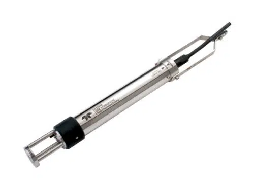
Teledyne Odom Digibar S
The rugged all stainless steel Digibar S was designed for un-tethered sound velocity casting. This configuration frees the probe from its electrical cable making deeper sound speed profiling a much easier and more reliable task.
- Rugged, stainless steel construction
- 500 meter maximum depth
- Records sound velocity, temperature, pressure and time
- Simple Windows based interface
With a 500 m maximum depth capability and storage for multiple casts, the “S’s” flexible design still maintains some of the best features of the popular Digibar Pro. Immediately before the unit is deployed, a simple system of flashing LEDs serves to confirm battery status, pressure sensor status, and overall probe operation. The confirming indicators drastically reduce the possibility of retrieving a deployment only to find that there is no data to show for the effort. Logging parameters are setup via a simple Windows interface communicating through your PC’s USB port. That same port is used to download the results of the cast and to charge the probe’s internal batteries. Cast data (sound velocity, temperature, pressure, and time) are stored internal to the probe in EEPROM. This means that critical measurements are maintained independently from the batteries that power the unit’s time of flight velocity determining circuitry, thereby providing an extra layer of security for the all-important cast results. Accurate, easy to use, rugged and reliable all appropriate descriptors of the Digibar S and the hallmark of Teledyne Odom’s product lines.
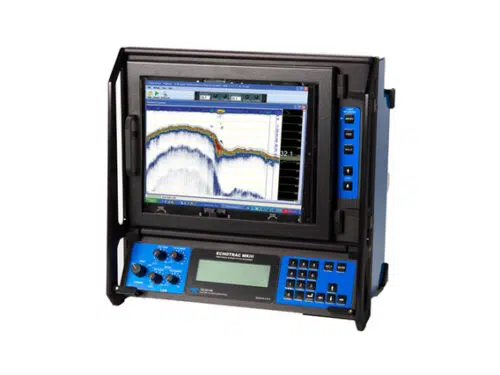
Teledyne Odom Echotrac MKIII
The Echotrac MKIII is the only sounder on the market offering you the choice of either a high resolution thermal paper recorder or a full-sized high bright color LCD chart in interchangeable module format.
Both high and low channels feature frequency agility, enabling the operator to precisely match the transceiver to almost any existing transducer. This ability minimizes near-surface noise caused by transducer ringing while increasing echo return strength. The MKIII is capable of both shallow and deep water operations and features unsurpassed interfacing flexibility with four serial ports and high speed Ethernet capability for maximum efficiency.
- Interchangeable paper chart or color LCD
- Multi-frequency (high: 100kHz-1MHz, low: 3.5-50kHz)
- Desktop, bulkhead or rack mount
- Internal data storage and playback with color LCD model
- Ethernet interface
- Optional built-in DGPS receiver
- Optional side-scan transducer
- Ultra shallow water transducer
- Flash memory upgrade
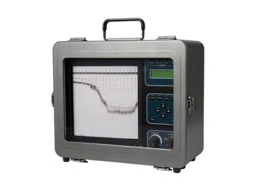
Teledyne Odom Hydrotrac
Specifically designed for work in less-than-ideal circumstances on small survey boats and inflatable watercraft, the HydrotracT offers compact portability and the confidence of knowing you’re using an Odom product.
It is completely waterproof and comes equipped with the same advanced features you’ve come to trust and depend on in Odom echo sounders.
- Ideal for small boats and harsh conditions
- Frequency Agile
- High Resolution Thermal Printer
- Internal DGPS (Optional)
- Waterproof
- Flash Upgradable
- Side Scan Option
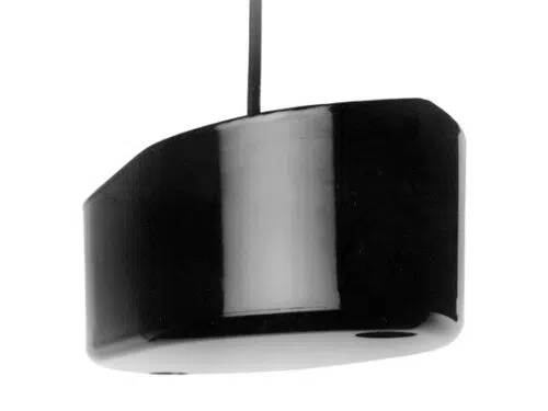
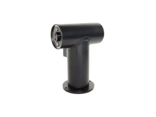
Teledyne Odom M42 Transducer
The M42 houses Odom’s best selling dual frequency transducer.
Compatible with any hull material, it is best mounted on a fairing.
Durable and reliable.
Teledyne Reson SeaBat 7125
The SeaBat 7125 continues to evolve with ever more powerful features for specific applications, and for enhancing productivity.
The fundamental acoustics continue to be class leading with 400kHz for high resolution, high density surveying which exceeds the most stringent of specifications, and 200kHz for greater range performance. The SeaBat 7125 can be installed on any platform from survey vessels to ROVs and AUVs down to 6000m water depth.
- Real-Time Pipe Detection and Tracking (optional)
- Multi-Detect (optional)
- Water Column Visualisation
- Dual Head Support
- Selectable Beam Density
- Tracker (Automation) -FP4
- SeaBat User interface -FP4
- Full Rate Dual Head (optional)
- X-Range (optional)
- FlexMode
Teledyne Reson SeaBat 8125
The new SeaBat 8125-H combines the 8125’s celebrated sonar head with an advanced data processor. Using 256 dynamically focused receive beams, the SeaBat 8125-H cuts a 120-degree swath across the seafloor. The result? Sea-floor detection is reliable, depth resolution is a crisp 6mm, and you can view backscatter intensity in real time on the sonar display.
The 8125-H’s advanced autopilot makes sure you cut the right swath first time every time, so you can focus on your survey data. And roll stabilisation enables you to complete your survey in inclement weather with no loss of accuracy.
For ROV deployment, you can optimise the 8125-H’s high-speed data uplink with a fibre-optic interface.
- FREQUENCY – 455 kHz
- BEAM DENSITY – Up to 512 beams in selectable modes optimises operations for any survey type
- SWATH – 120° swath angle
- EASY UPGRADE – Fast, simple, economical upgrade
- NEW PROCESSOR – New sonar processor only, no changes to existing 8125 head or cables
- PERFORMANCE – Improved raw data display and water column
Teledyne Reson SeaBat 8160
The SeaBat 8160 provides an unbeatable combination of range, resolution & profitability, a first for a system of this frequency range.
The SeaBat 8160 transducer array is comprised of a linear receive and transmit array mounted together on a support base. The T-shaped array geometry provides the basis for a compact, high-resolution sonar which is easily installed for portable or hull mounts – a first for a high-resolution system in this frequency range.
The system features a pitch-stabilized transmitter and an active roll compensated receiver.
The SeaBat 8160 processor is compatible with other Sea-Bat sonar heads. It can be updated in minutes to accommodate future requirements and features a user-friendly point-and-click interface.
- High-resolution sonar which is easily installed for portable or hull mounts
- High performance – excellent swath
- Continental shelf mapping wizard
- Processor is compatible with other SeaBat sonar heads
- Versatile
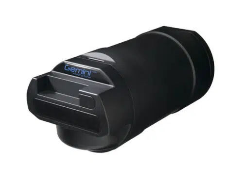
Tritech Gemini 720id
The Gemini 720id is a deep-rated multibeam imaging sonar. Utilising an array of transducers, the 720id provides the operator with 120 degree constant swathe of the underwater scene ahead. The Gemini 720id is part of Tritech’s Gemini multibeam family. Network all your Tritech sensors together via Seanet Pro Software, choose the Gemini Standalone Software for control and display or upgrade to Gemini SeaTec Software for target tracking and object detection.
- 4000m depth rating
- Real time imaging sonar
- Wide field of view
- Ethernet or VDSL communications
- Network all Tritech sensors in Seanet Pro
- Gemini SeaTec Software upgrade available
- Software Development Kit available
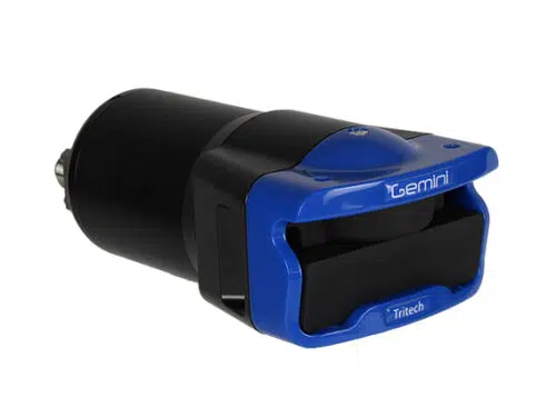
Tritech Gemini 720is – Multibeam Imaging Sonar
The 720is is the latest generation from Tritech’s renowned multibeam sonar range and offers a real-time, high frequency imaging solution. The Gemini 720is operates at 720kHz and this combined with Tritech’s state-of-the-art processing electronics, produces images of superb clarity. This latest design is ideal for pan and tilt mounting on observation class ROVs.
With a 120° field of view and a fast update rate of 30Hz, the Gemini 720is is ideal for poor visibility environments.
The Gemini 720is is supplied with Seanet Pro, Tritech’s data acquisition and logging software, which offers users the ability to network and operate the sonar along with a range of other Tritech sensors from a single software interface. The Gemini standalone software also provides users with additional control over the Gemini 720is and can be upgraded to Gemini SeaTec to provide a variety of target classification and tracking capabilities. The capability to record data in a range of digital video formats and output screen shots for review comes as standard.
- 720kHz operating frequency
- Wide 120° field of view
- Real-time updates for video like imagery
- Integrated velocimeter for accurate ranging
- Ethernet or VDSL communications
- Software Development Kit available
- SeeByte target tracking capability