Close Menu
- Acteon Home
- Industries
- Divisions
- Products & Services
- Integrated Solutions
- About Acteon
- Contact us
Search products
X Products selected
No matter how much raw data has been collected from the survey site, it’s the results that your client values. When budgets get tighter, survey tasks become ever more time-critical and the process of interpreting acquired data must be as quick and easy as possible.
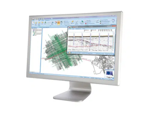
Coda GeoSurvey Productivity Suite integrates the tasks of analysing, tagging and mosaicing complex data sets – thereby ensuring faster and more precise results.
With Coda GeoSurvey running on multiple workstations with remote networked data storage, high volumes of geophysical data can be managed and processed quickly, maximising productivity.
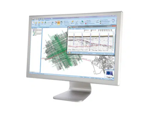
Survey Engine Seismic+ is a ‘next generation’ 2D seismic data processing, interpretation and reporting application for the marine survey industry.
Built on the years of experience that have made CodaOctopus’ software solutions a market leader at the heart of geophysical operations worldwide, Seismic+ brings survey tools up-to-date with the latest database and GIS technology. Based around a flexible database, Survey Engine gives fast access to all survey information, even from the largest data sets. As a result, Seismic+ offers exceptional time-saving advantages when reviewing data and performing interpretation. Designed with thousands of line kilometres of survey data in mind, we believe that Survey Engine Seismic+ is the most productive and intuitive tool available for seismic data processing, interpretation and reporting.
Seismic+ integrates fully with Sidescan+ so that both sidescan and seismic data sets can be used in the same project yielding interpretation productivity benefits.
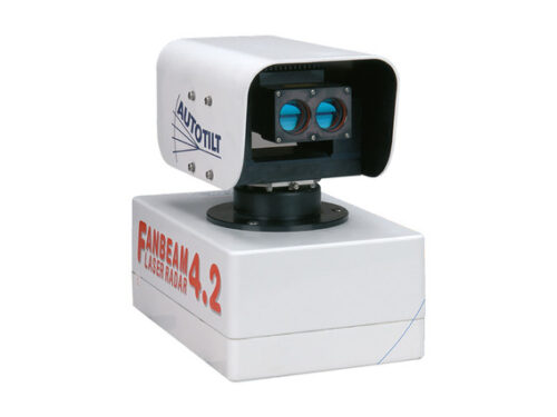
MDL’s Fanbeam® system is a laser based positioning sensor designed for repetitive, high accuracy range and bearing measurements from offshore support vessels and other marine structures.
The system is primarily used as a dynamic positioning (DP) reference sensor measuring the position of an offshore support vessel (OSV) relative to an offshore structure such as a platform. Using the position data from the Fanbeam and other sensors, the DP system automatically holds the vessel on station allowing operations to take place. The system is regularly used as the primary position reference during critical short-range operations such as cargo container lifts from platform supply vessels.
The system has also been extensively used for seismic source positioning relative to geophysical exploration vessels and for positioning mine detection equipment relative to navy vessels.
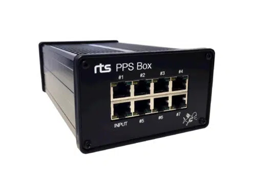
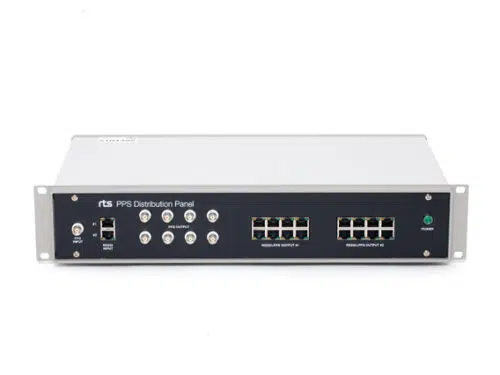
Based on the RTS PPS Distribution Panel, the RTS PPS Box is a highly compact and robust solution for distributing GPS timing signals to survey spreads.
The unit features low latency distribution of one timing telegram together with PPS pulse to seven separate outputs. The RTS PPS Box is typically used for time synchronisation of sensors and logging systems.
The RTS PPS distribution panel is the key solution for distributing GPS timing signals to survey spreads. It can be used to distribute one or two separate timing telegrams together with PPS pulse.
The system consist of two RS232 splitters combined with three PPS pulse splitters. Selectable PPS pulse width, 500us, 1ms or directly from the GPS. Selectable PPS trigging, positive or negative edge. Typically used for time synchronisation of logging systems and multiple sensor synchronization.
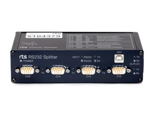
RS232 splitter for distribution of sensor signal to multiple computers. Simplifies setups and make a well arranged interconnection between computers and sensors. No more unpredictable RS232 signals caused by serial ports connected in parallel. A special duplex output connector, CH1/CH2, makes it easy to do sensor configurations without any bypasses or disconnections.
