


Geophysical site characterisation
COMPREHENSIVE SEABED STRUCTURE SURVEYS FOR SAFE AND COST-EFFECTIVE MARINE INFRASTRUCTURE DESIGN
Acteon is an integrated survey provider with specialist tooling and advanced equipment to provide high resolution, accurate data mapping and interpretation across reconnaissance, route and site surveys using vessels, remote vehicles and seabed systems.
Accurate and timely seabed geophysical surveys are essential to the cost-effective design of marine structures and subsea installations.
By working in partnership with Acteon, contractors and operators benefit from:
- Business-critical data using the most advanced sensors and data recording systems.
- Acquisition and processing of high-resolution geophysical data ensuring accurate site characterisation enabling customers to manage fundamental data over a project life cycle, thereby driving costs out of offshore planning and construction
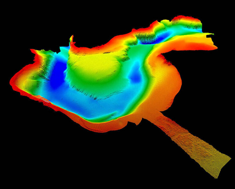
- Maximum data insights by using non-invasive, rapid, mapping of the seabed to avoid surface disturbance and/or any risk of uncovering buried hazards, limiting impact on marine life.
- Web-based visual asset management using iSite allowing clients to remotely access their marine energy assets from their desktop, helping to eliminate the cost of offshore planning, operations and communication.
Solving your most pressing challenges
Acteon provides interpretation of accurate geophysical data to accelerate project development for customers while reducing risk and avoiding overengineering.
Acteon solution
Acteon delivers the optimal survey to provide the level of accurate, reliable data required for each situation and water depth. We use consultancy to develop highly effective surveys that meet the required project specification.
Proof points
- We reduce offshore resources using ASVs and AUVs which minimises travel costs and the associated carbon emissions.
- By validating the development of a minimal foundation, we enable a smaller project, which results in a shorter build cycle using less equipment and fewer dynamically positioned vessels.
- We have pioneered the use of ASVs for fast, highly effective mapping of the seabed and continue to drive innovation and industry firsts.
Read the case study
Doubling survey capabilities accelerates wind project operations
Acteon solution
Acteon uses advanced technology to provide high-quality shallow-water data to support nearshore projects through the broad characterisation of the seafloor structure. We can mobilise purpose-built, shallow-water vessels and apply our expertise when deploying bespoke shallow-water sensors.
Proof points
- We have developed a small, lightweight launch-and-recovery system devised for use in remote, hard-to-access regions along with lightweight, special-purpose survey tools to facilitate small-scale work.
- Experts in deploying purpose-built shallow water sensors.
- We can establish local control datums where they do not exist.
- We have a long track record for remote work in Alaska.
Acteon solution
We define a solid basis of design in support of our customers’ offshore FEED studies. Our production team converts raw data into a basis for design that is underpinned by survey consultancy to develop highly effective surveys that meet each project’s requirements.
Proof points
- Pioneered the use of USVs for fast, highly effective mapping of the seabed and continue to drive innovation and industry firsts.
- Off the US East Coast, we have acquired over 40,000 km of SAP and COP survey data working on offshore wind projects including Bay State Wind, Mayflower Wind, Atlantic Shores, Vineyard Wind 1 and 2, Coastal Virginia and Kittyhawk.
- We are vessel agnostic with a modular spread to allow for utilisation of any suitable vessel, also allowing us to choose the optimal vessel size to keep costs down.
Acteon solution
Acteon can provide full-field characterisation to support a customer’s regulator COP. Our production team turns raw data into useful insights to help expand an SAP into a COP, thereby minimising additional work. This is supported by a flexible and rapid call-off inventory around the globe.
Proof points
- More than 40,000 km of surveys completed for US East Coast wind farms, multiple cable installations and the AT&T Pebble Mine in Alaska.
- Extensive experience in performing full-spread geophysical COP surveys to minimise environmental impacts and create commercial efficiencies for customers.
- We capture the seabed structure using advanced technology to provide the critical data within raw, processed and analysed formats as required.
Read the case study
Subsea surveys and inspections for the Coastal Virginia Offshore Wind pilot project
A proven suite of products and services
We interpretate accurate geophysical data to accelerate project development
Geo-services specialisms
Offering a single point of contact to drive project efficiency; our focus is to reduce the cost, complexity and time to access superior geo-data.